|
On Saturday, I packed my bags, said goodbye
to Mme. Fabre and moved to my new digs in Eygalières, the
next town heading south. While Mollégès was a quaint little
town and the room I had was immaculate and charming, my new home
is superior in several ways, but more on that later.
Sunday was a beautiful day so I elected
to go on a 3 hr., 9 km hike that I had my eye on for a few days.
The Twingo and I set out for Fontvieille, a few miles to the southwest.
|
|
|
|
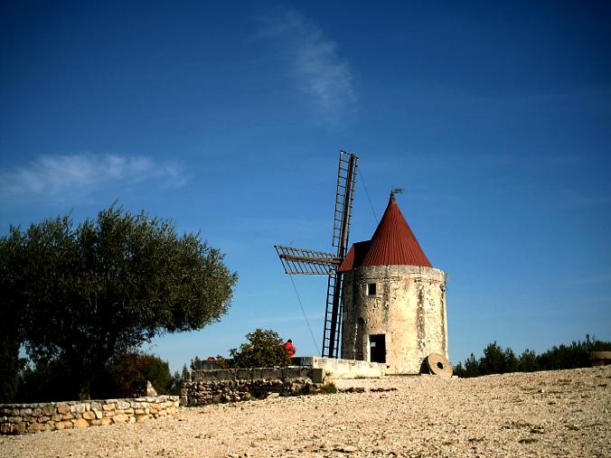
Alpohonse Daudet (1840-1897) was
a Provence native from Nimes who, while educated as a lawyer,
became one of Provence's best known writers of short-stories
and novels. He lived in Fontvieille for a short while where
he wrote one of his most renowned works Lettres de mon
Moulin (Letters from my Mill). During this period,
he lodged at the Château de Montauban (also along
the hike) where he often took strolls past the four surrounding
windmills. These mills inspired him to write Lettres,
which is a collection of fictional letters and tales written
by the narrator depicting the everyday life and struggles
of the people of Provence.
Only one of the windmills still stands
intact on a plateau overseeing the Rhône valley towards
Tarascon. For a small fee you can go to the top of the windmill
and in the small Daudet museum on the first level. I, of
course, did neither. In fact, I had never heard of Daudet
and had to read about him on the Internet just to write
this much. |
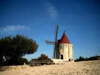
Le moulin de Alphonse
Daudet
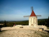
The same looking
towards Tarascon.
|
|
|
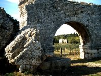
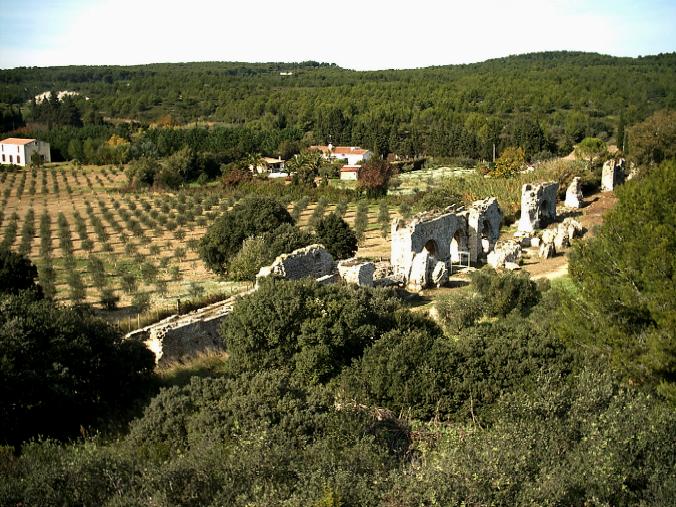
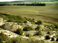
Ruins of the aqeduct
with an olive grove in the background..
|
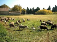
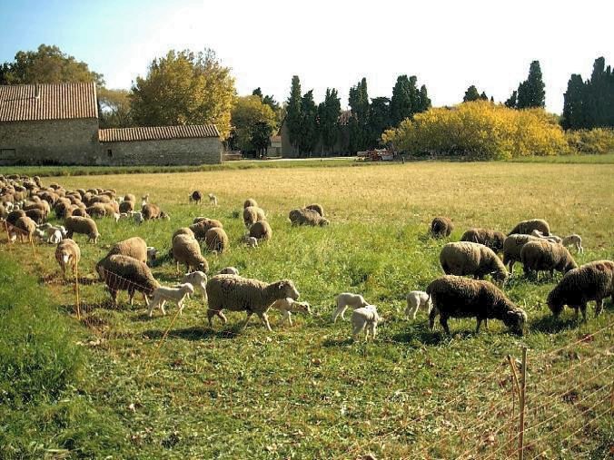
Les sheep.
|
|
| 
The aqueduct feeding
the mill at Barbegal.

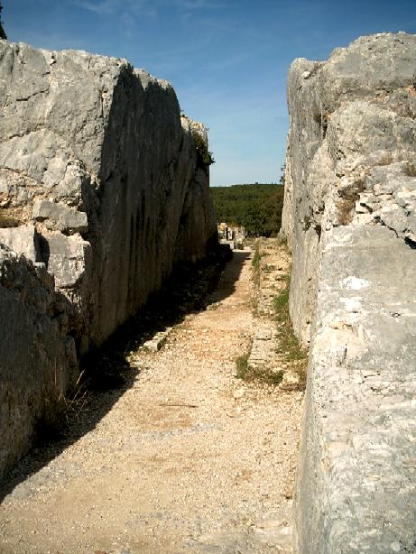
The final channel
carved in the host rock leading to the mill.
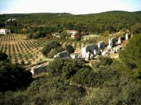
The ruins of the
eight mills at Barbegal.
|
At the furthest part of my hike,
I approached the mill at Barbegal – the real reason for
the undertaking. I mean Daudet is great and all that, but
we’re talking ruins of a Roman engineering marvel here.
The mill at Barbegal is estimated to have been built in
the 2nd century and had eight churning grindstones. I read
they could produce 9 tons of flour a day, enough to satisfy
all 12,000 inhabitants of the Roman capital of Provence
at Arles.
The water to power the mill was directed
from the southern part of the Alpilles by 11 km of aqueduct.
Some of the remains of the aqueduct still remain and are
shown in the pictures above and top left. The water was
fed through a channel carved into the rock of the hill (middle
left) and plunged over the face of the hill to turn the
water wheels that drove the grindstones of the mill (bottom
left) the water then was channeled to the fields surrounding
the mill to produce more wheat.
A brisk walk back to Fontvieille
and it was off to the café for a pastis
and a bite to eat. The French system of randonnée
(hiking) trails is actually very well organized. There are
the national long-distance Grand Randonnée trails
and smaller regional and local paths. All are marked with
distinctive colors and shapes. If you are on the trail,
you’ll see a "–" in the color representing your trail. Each
intersection or fork will usually have an "X" in the same
color denoting that this is the wrong way. Abrupt changes
in direction are marked with "L" indicating the appropriate
direction. Sounds like a pretty simple system, except that
they don’t use artificial signage, instead painting the
markings on trees or rocks. So whenever you approach an
intersection, you have to meander up each option slightly
to find the appropriate marking being sure to look down
around your feet as well as up at the trees. Several times,
I’ve gotten slightly off track because I missed a marking.
Slightly helping the situation are the books published detailing
30-40 trails in each department of Provence (Bouches-de-Rhône,
Gard, Luberon, etc.). But it’s still a little tricky, especially
when a hike requires you to change colored trails multiple
times. |
|
|
|
I find myself keeping a pretty close
eye on the weather. Not that any of these pictures show it, but
it has rained about half of the days since I arrived. Wind is
also something to be wary of. If it blows from the south, it is
warm and can actually carry fine particles sand from the Sahara.
If it blows from the north through the Rhône valley, it
can be bitter cold. This northerly wind is called a Mistral, after
the most famous proponent of the Provençal culture. Nobel
poet-laureate Frédéric Mistral is credited as single-handedly
reviving the Provençal language with his poetry and established
a foundation to keep the culture alive. So they honor him by naming
a cold wind after him. Nice.
So anyway, I was glad to see the forecast
predicting nothing but sunshine for most of the week. A colleague
of mine told me it was because of an anticyclone over
the south of France. I had never heard this term before, so I
asked her what it was. She said, “It’s like a cyclone, but the
opposite.” Well I wasn’t really sure what to make of that, so
my interpretation based on the weather report on the news is that
it meant a high-pressure cell. The point here being that the weather
was going to be good for a few days, so I took advantage of it
and left work early one day to take another hike.
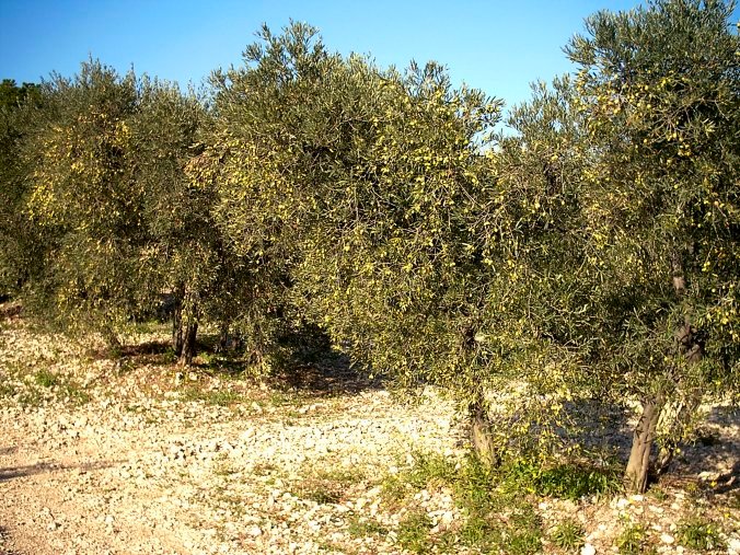
I knew from Mme. Fabre that this week and the next were peak
olive picking times. I had read about a hike that wandered through
a number of olive groves in the areas around Mouriès where
an estimated 80,000 trees are harvested each year. While there
are wild olive trees in Provence, the variety grown in the orchards
today throughout the region were introduced by the Greeks some
2,600 years ago. Marseille was actually founded by the Greeks
as a major trading port called Massalia. It wasn’t until later
that the Romans moved in and introduced vineyards.
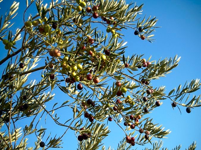
From what I’ve seen, green olives come
from the same trees as black olives, the black ones just being
ripe. The oliviers (olive growers) harvest the olives
by spreading a net around the tree and scraping the branches with
what looks amazingly similar to those plastic rakes that kids
use at the beach. Each tree is done by hand until the whole orchard
has been harvested. The olives are taken to the press, and the
first press produces the premium extra virgin oil. A second pressing
with cold water yields extra fine oil, and a final press using
hot water will produce a commercial olive oil. A single tree can
produce as much as a gallon of olive oil.
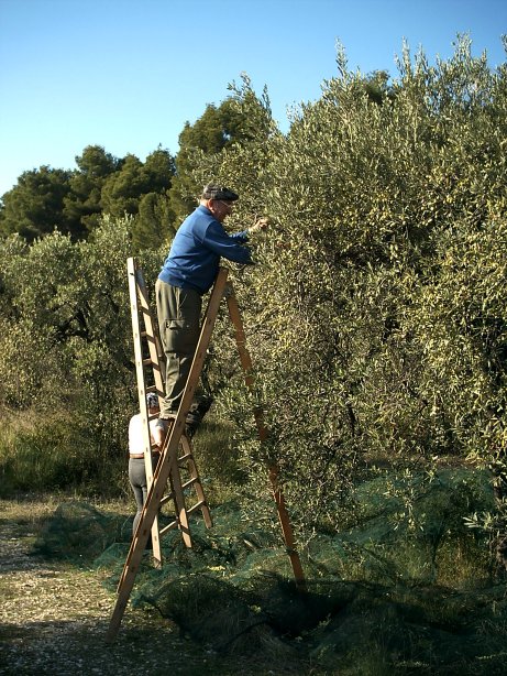
The gentleman below and his wife are typical
oliviers. By the way, I asked his permission prior to
photographing him. In fact, his wife climbed down off of the ladder
because she didn’t feel she was dressed appropriately for the
picture. Little did she know it would end up on the Internet.
Anyway, he and his wife have approximately 220 trees to harvest
this year. It will take them about 2 full weeks. He asked me if
I would be back next weekend to help, but I told him that I didn’t
have the right work permit.
|
|
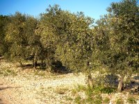
Olive trees ripe for
plucking. |
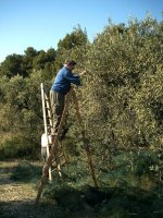
Un olivier applying
his trade. |
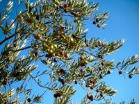
The fat, oily olive. |
|
|